Location and Key Facts
Ashford’s Story
Ashford sets a remarkable example of inward investment success – capitalising on its highly accessible location through bold investment and a proactive attitude, to create a thriving place to work, live and do business.

Competitive property costs, both commercially and residentially, desirable workforce costs and a commercial scene that is bursting with sector strengths, all within 38 minutes of London also contribute to putting Ashford on the map.
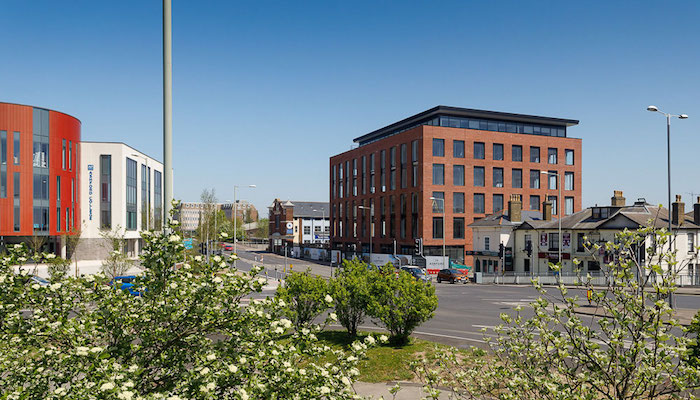
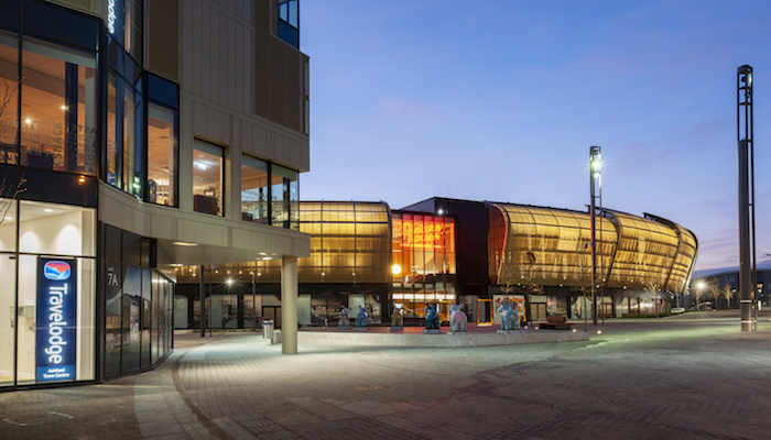
Eight major new developments have changed the face of the area in recent years – from the state-of-the-art Ashford College to the Elwick Place leisure complex right in the town centre.
Watch Ashford’s story
Where is Ashford?
Ashford is everything you want from an urban area, yet provides the very best of town and country. Step out of Ashford and you will find the idyllic Kent countryside, market towns like Tenterden, award-winning vineyards and heritage houses and railways.

By train
Undoubtedly, Ashford’s first class national and international transport links play a major part in the town’s success. Southeastern’s Ashford to London service from Ashford International train station is just 38 minutes by high speed rail.
By road
Ashford’s Kent location on the M20 corridor provides fast access to the rest of the county, the UK or across the English Channel by road, and junction 10a is expanding with a £104m project unlocking potential for further growth.
By air
London’s two main airports are within easy reach. By car, Gatwick is an hour away with Heathrow only a further 30 minutes around the M25.
When looking Ashford, location is everything, making it the smart move for your home or business. However you choose to travel, business leaders on tight schedules can get where they need to be quickly and conveniently.
Ashford key facts

38 minutes from London
Easy access to mainland Europe
Lower Rateable Values (RV) leading to lower Business Rates compared to the London area
Much lower commercial property rents compared to London
Lower workforce costs
Two motorway junctions onto M20, and new junction 10a opened at the end of 2019
Investment pipeline of over £300m in the coming years
£14.7 million levelling up funding in Ashford
Ambition for Ashford as a borough to be net zero by 2050
Two areas of National Landscapes (formerly AONB) - High Weald and Kent Downs
Home to 53 ‘good’ and ‘outstanding’ primary and secondary schools
South Ashford Garden Community (SAGC), three developments representing 7,250 new homes
House prices in Ashford around a third cheaper than London (UK House Price Index, July 2024)
Ashford has 410 food and drink enterprise, the largest cluster in Kent
A digital creative hotspot in the South East of England, 540 digital creative businesses in Ashford